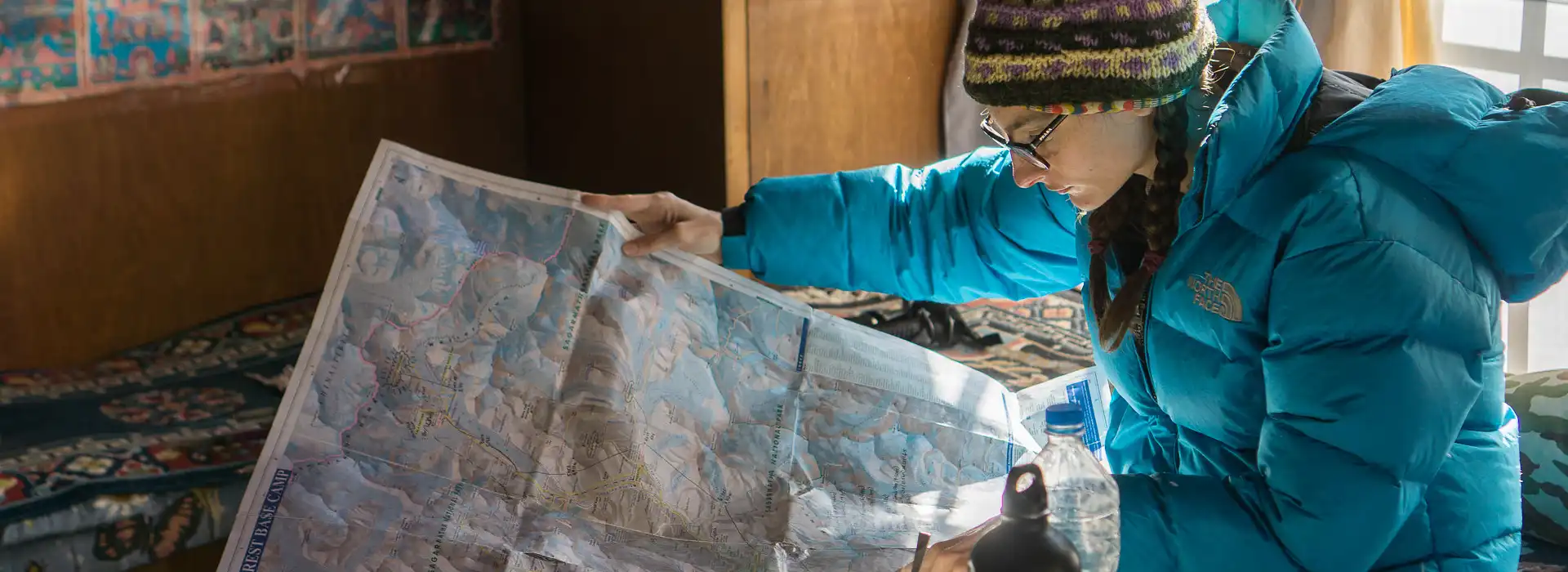
A lot of adventurers from various parts of the globe desire to be at the Everest Base Camp. Everyone needs a reliable Everest Base Camp Map to overcome the difficult twists and turns along this trek. The map is essential not only because it shows a detailed illustration of the trail but also because it helps the trekkers mentally and logistically get ready for the trek ahead, hence enabling them to know what to expect in terms of terrain and daily mileage.
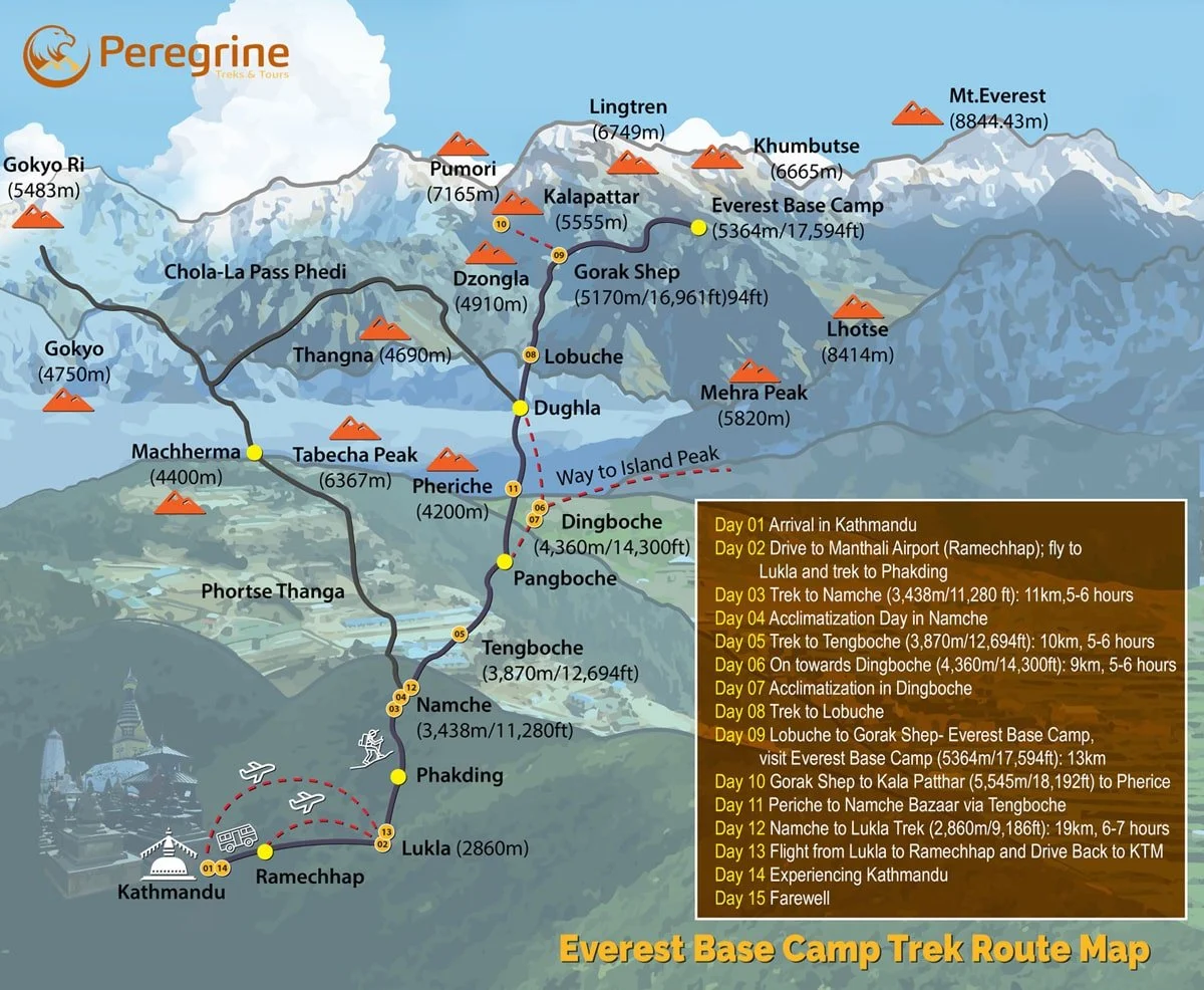
The Everest Base Camp Trek Map serves as an indispensable navigational companion, providing deep insights into the main route and its numerous landmarks. It outlines every key point from Lukla, the gateway to Everest, through Namche Bazaar to the base camp itself. The map identifies crucial rest stops, points of interest, and elevation changes essential for acclimatization and daily trek planning.
The EBC Trek Map displays alternative routes like the Gokyo Lakes or the challenging Three Passes Trek, offering experienced trekkers the chance to tailor their adventures. The Everest Base Camp Map Route also marks teahouses, clinics, and rescue points, which are vital for safety and comfort. By providing these details, the map equips trekkers to thoroughly prepare and engage with the majestic beauty of the Himalayas, making their expedition not only possible but also truly memorable.


The trek to the Everest Base Camp sets off from the village of Lukla and moves north to Namche Bazaar. Along the way, the path takes a right turn, proceeding unto the east, leading adventurers into Pheriche or Dingboche. Usually, this part would entail a fair walk per day that takes approximately 4-6 hours.
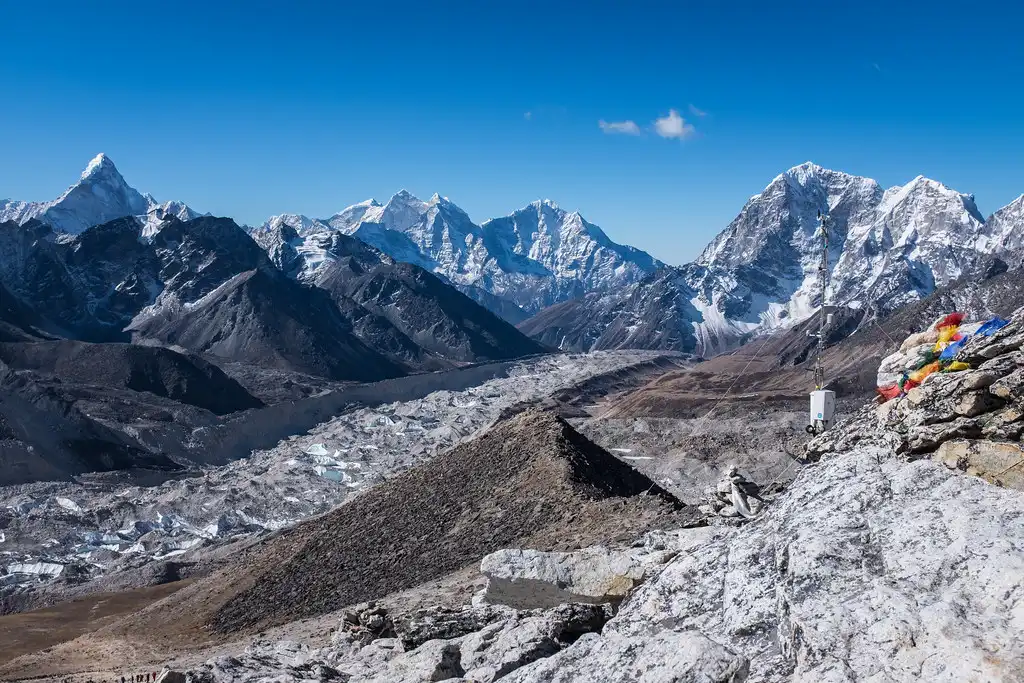
The path becomes rocky and rugged when continuing from Lobuche, at an elevation of 4,940 meters, to Gorak Shep, at 5,164 meters. Moreover, trekkers must maintain a steady pace during their ascent to Kala Patthar, which sits at 5,500 meters. The hike becomes increasingly strenuous as the changing altitude begins to affect the body, making it essential to be aware of these conditions.
We recommend that you take a look at the Everest trek map to familiarize yourself with the altitude gains ahead. This preparation allows you to gear up for the significant climb to higher elevations adequately.
To overcome the challenges along the route, trekkers must possess good physical fitness, as the trek covers a total distance of 130 km. The obstacles faced on the trail enhance the adventure, making the trek an unforgettable experience.
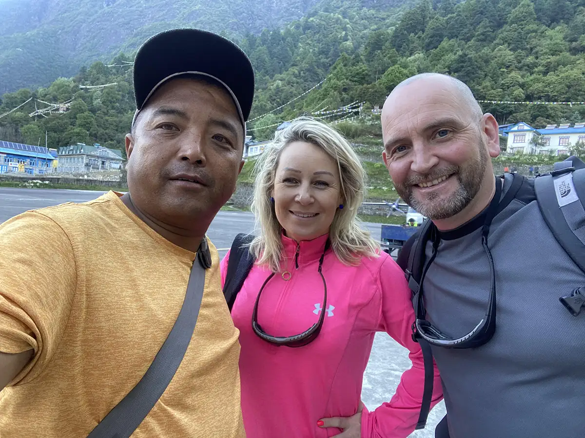
A nice place to start your trek to Everest Base Camp is the village of Lukla. It’s located at 2800 meters above sea level and can be the first place you start feeling some initial symptoms of high altitude disease.
From Lukla, you will proceed towards the majestic foothills of the world’s highest mountain. During the trek, you will stop at various places for overnight stays, enjoying a splendid trekking experience in the serene Everest region that typically wraps up within two weeks.
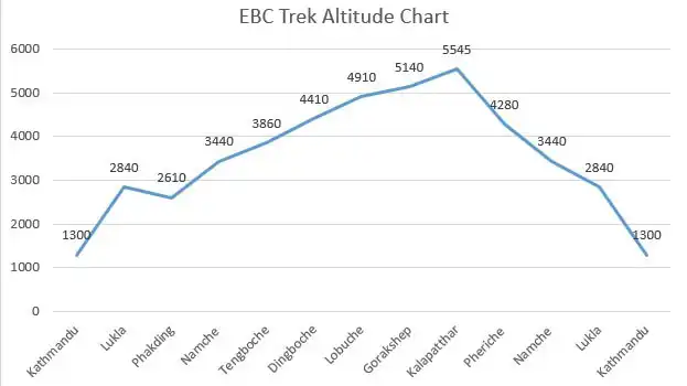
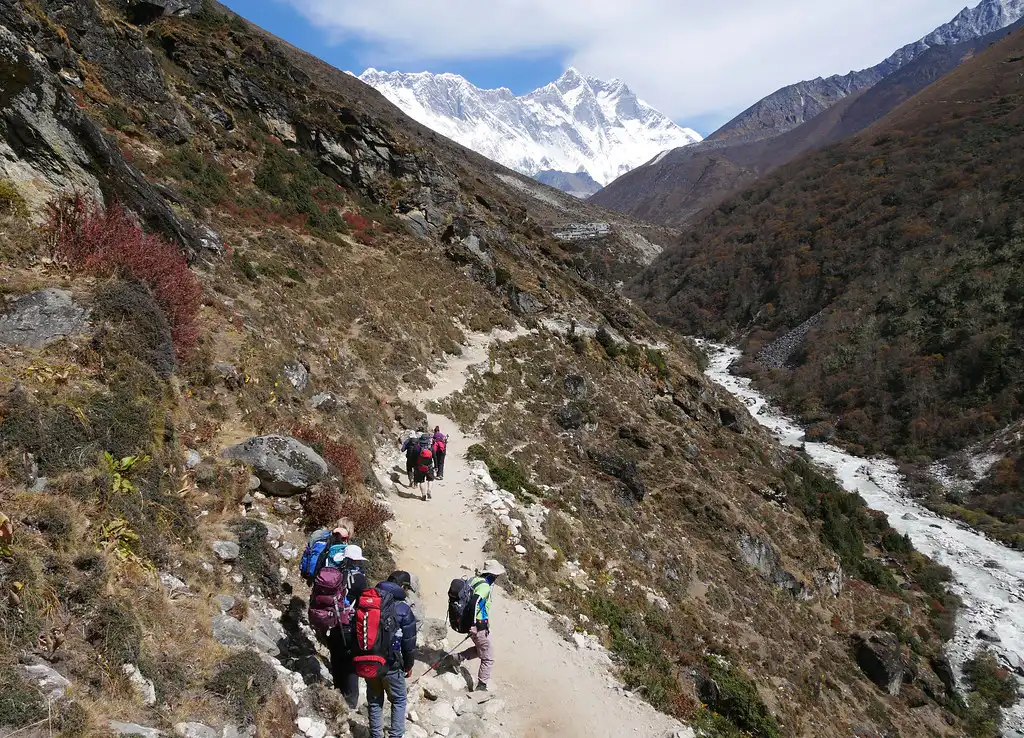
For a significant portion of the trek, your route will take you to altitudes over 3000 meters, requiring periods of acclimatization. The Everest region also offers other trekking opportunities, such as the 3-pass trek, EBC, and Gokyo Lake, with variations in altitude gains, durations, and trek lengths depending on the selected trekking packages.
During four days, guests enjoy the experience of being surrounded by wildlife in their natural habitat within the Selous Game Reserve, one of the most significant wilderness zones in the world and under the auspices of the Tanzania Wildlife Authority. On day three of the tour, guests have the opportunity to watch twenty of the species found within the reserve.
Altitude: 1,350m/4,428ft
You will be landing in Kathmandu, the lively capital of Nepal known for its rich cultural heritage and historic significance. Our team will ensure that you are checked into your hotel after you complete the formalities at the airport. Your guide will take you through trek particulars during an orientation session in the evening to equip you for what lies ahead in this undertaking. Since the trip starts early in the morning, make sure you get enough sleep.
Altitude: Lukla – 2,800m/9184ft; Phakding – 2,652m/8,698ft
Walking Distance: Approx 8km (3-4 hours); Flight Time: 35 min
Take a scenic morning flight from Kathmandu to Lukla, your gateway to Everest.
Upon landing, meet your porter and start the trek. The path leads you through Chaurikharka village and down to the Dudhkoshi River, with a stop for lunch at Thade Koshi. You will spend the night in Phakding to acclimate to the higher altitude.
Altitude: 3,440m/11,283ft
Walking Distance: Approx 10-12km (5-6 hours)
Traverse enchanting pine forests on your way to Monjo, where you enter the UNESCO-listed Sagarmatha National Park.
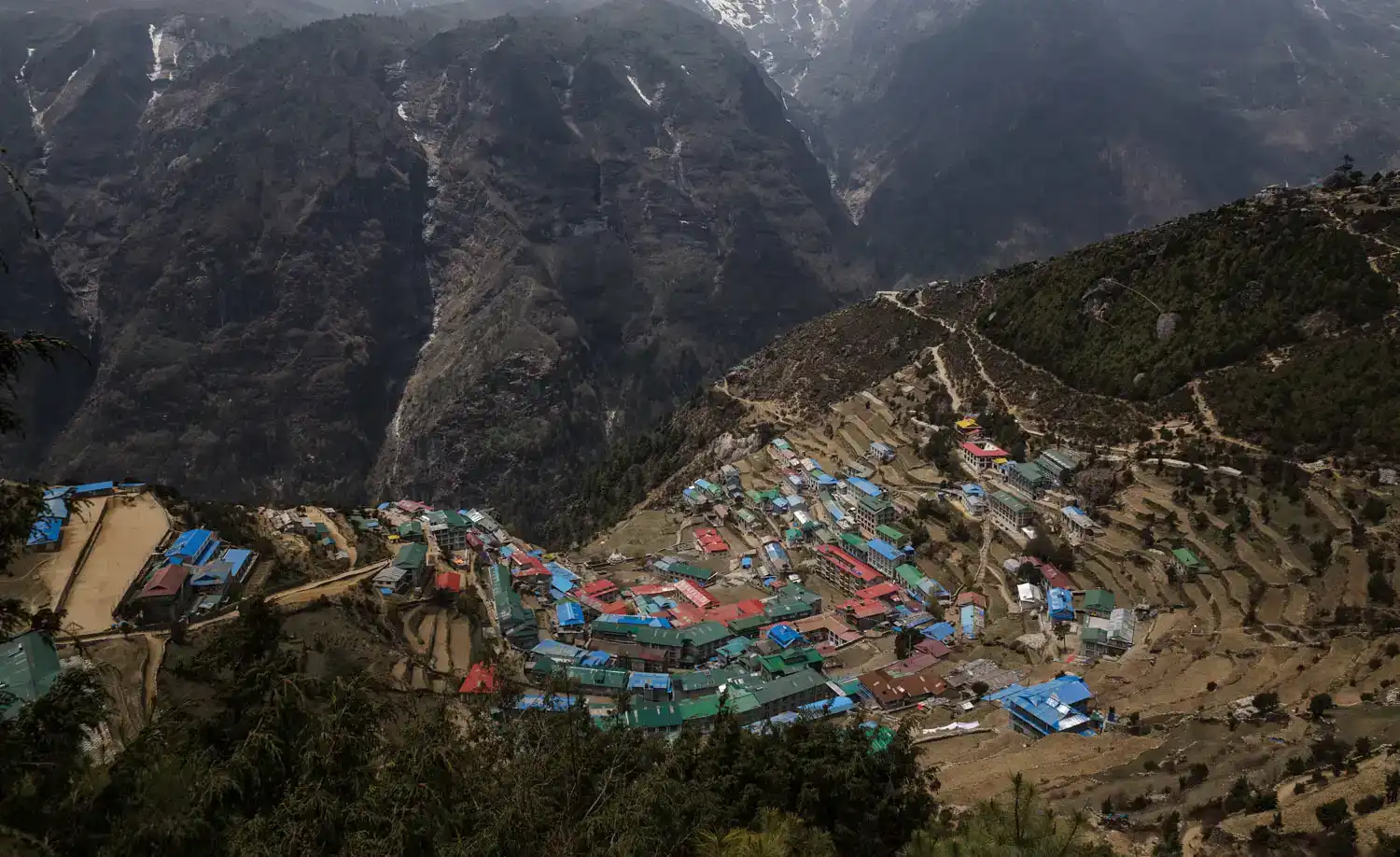
Once you have crossed the Dudhkoshi River, ascend steeply to Namche Bazaar, which is vibrant and serves as a hub in the Khumbu region. It was historically a trading center for the Sherpa community. In the evening, you can go around the local shops and cafés.
Altitude: 3,440m/11,283ft
Acclimatize to the high altitude by engaging in short hikes to attractions like the Everest View Hotel or Syangboche airstrip, which offer stunning panoramic views of Everest and the surrounding peaks. Learn about local history and mountaineering at the Sherpa Culture Museum. If it’s Saturday, explore the Haat Bazaar, where traders sell everything from fresh produce to trekking gear.
Altitude: 3,870m/12,684ft
Walking Distance: Approx 10km (6 hours)
Begin the day with a descent to the river, then climb steadily to Tengboche, known for its famous monastery, a spiritual center for Sherpas. The route offers mesmerizing views of Ama Dablam and other high peaks. Explore Tengboche Monastery and observe the monks during their prayers, adding a spiritual dimension to your trek.
Altitude: 4,400m/14,435ft
Walking Distance: Approx 11km (6 hours)
Follow the trail from Tengboche through lush rhododendron forests to Deboche, cross the tumultuous Imja River, and proceed to Pangboche, one of the highest permanent settlements in the valley.
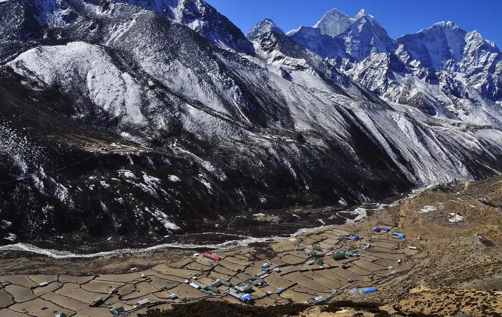
Interact with local Sherpas and consider visiting the Pangboche Monastery. After lunch, the scenery shifts as the greenery gives way to arid landscapes, leading you to Dingboche, a picturesque village used by climbers as an acclimatization stop.
Altitude: 4,400m/14,435ft
Spend this day acclimatizing in the breathtaking surroundings of Dingboche. Engage in short hikes to the nearby Chhukung Valley and Imja Glacier, which offer spectacular views and the chance to observe unique geological formations. Interact with local Sherpas, gaining insights into their culture and lifestyle and enhancing your trekking experience.


Altitude: 4,900m/16,076ft
Walking Distance: Approx 11-12 km (6-7 hours)
Trek to Lobuche, a small settlement high in the region. The trail passes through Dungla, featuring memorials to climbers who have perished on nearby peaks.
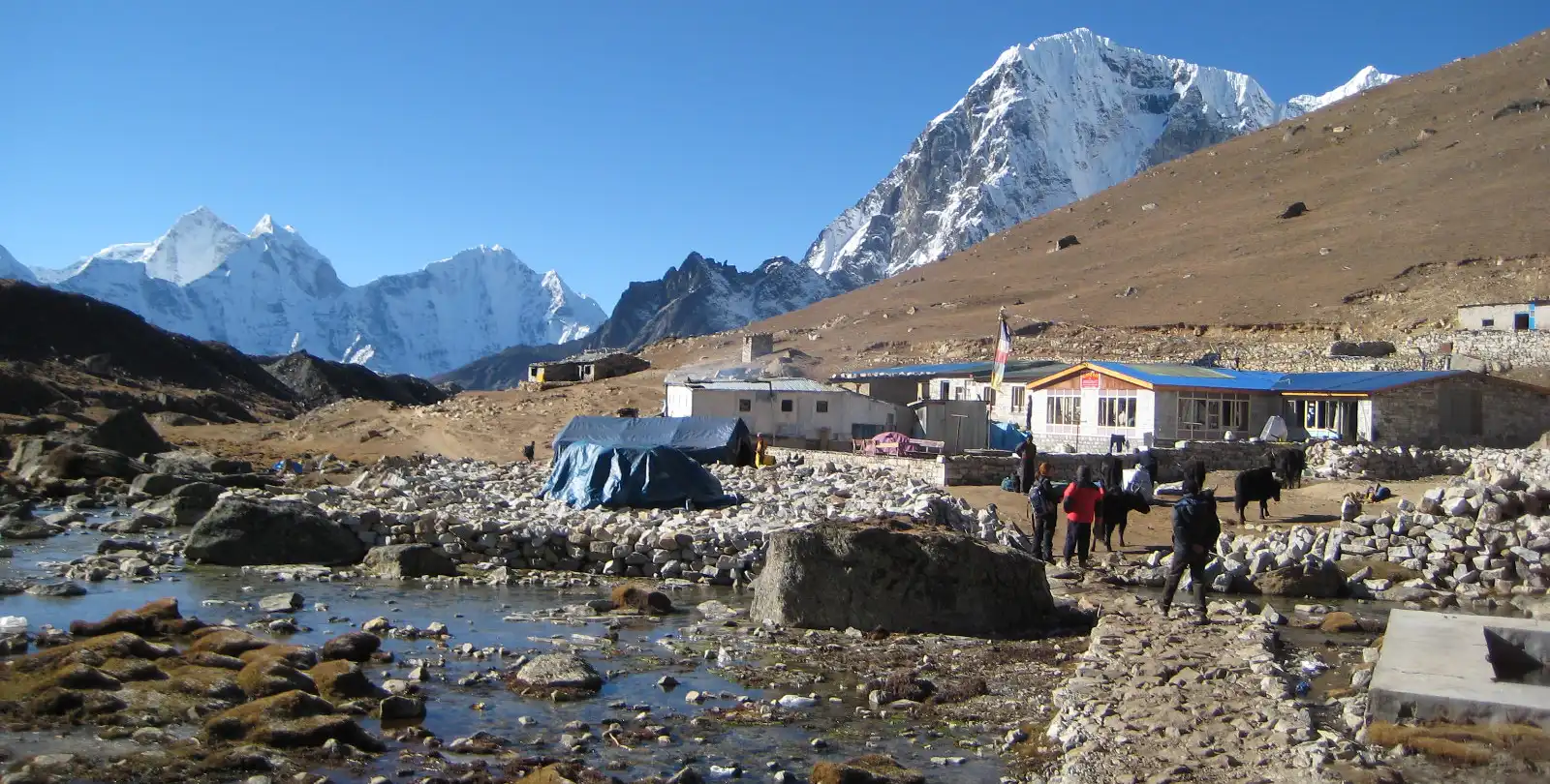
After reflecting and having lunch in Dungla, continue your ascent to Lobuche, where dramatic views of Lobuche East and West, Pumori, and Nuptse await.
Altitude: Gorak Shep – 5,180m/16,994ft; EBC – 5,364m/17,598ft
Walking Distance: Approx 15km (6-8 hours)
Proceed from Lobuche to Gorak Shep, the final stop before Everest Base Camp. Walk alongside the Khumbu Glacier, observing its massive ice formations up close. Continue to Everest Base Camp, experiencing the excitement of mountaineers preparing for their summit attempts. Spend some time at the base camp, then head back to Gorak Shep for the night.
Altitude: Kalapatthar – 5,545m/18,192ft; Pheriche – 4,320m/14,173ft
Walking Distance: Approx 12-13km (5-6 hours)
Start early for a hike to Kalapatthar to witness the sunrise over Mt. Everest, providing unforgettable photographic opportunities.
After breakfast, back in Gorak Shep, descend to Pheriche, a quieter village that offers a peaceful setting for recovery after the day’s exertions.
Altitude: 3,440m/11,284ft
Walking Distance: Approx 13-15km (7-8 hours)
Begin your descent to Tengboche, enjoying lunch and possibly a final visit to the monastery. Continue through beautiful, forested trails down to Namche Bazaar, offering a comforting sense of return as you approach the end of the high-altitude segment of your trek.
Altitude: 2,800m/9,184ft
Walking Distance: Approx 16km (6-7 hours)
Descend through the lush forests of the lower Khumbu region to Jorsalle, then follow the Dudh Koshi River to Lukla. Spend your last evening in the mountains reflecting on your trek and celebrating with your trek team and fellow trekkers.
Altitude: 1,350m/4,428ft
Flight Time: 35 min
Take an early morning flight from Lukla to Ramechhap, then drive back to Kathmandu. Enjoy a farewell dinner with cultural performances in the evening, celebrating your successful completion of the trek.
Reserve this day to handle any potential flight delays from Lukla, which are common due to the area’s unpredictable weather. If the flights run on schedule, use this extra day to explore Kathmandu’s rich cultural heritage, visit temples, or unwind.
Altitude: 1,350m/4,428ft
Make the most of your final day in Nepal by shopping for Nepali handicrafts, perfect for souvenirs. Our representative will escort you to Kathmandu International Airport three hours before your flight, bidding you farewell until your next adventure.
Carrying an Everest map throughout your trek is crucial as it holds vital information that significantly influences your trekking experience.
This essential tool enables you to evaluate critical factors such as altitude, distance, and the geographical layout of the region. Here are several key reasons to always have a map:
For solo travelers, having a map is particularly beneficial since it’s common for trekkers to deviate from established paths. A map keeps you informed about restricted areas along the Base Camp route, increasing your trail awareness and overall safety.
A trekking map provides valuable insights into the distances to your destinations. It serves as a reliable reference for important trek details that are easy to overlook or forget.
A map is an indispensable tool that enables spontaneous explorations away from the main trekking paths. It facilitates visits to interesting nearby sites, enhancing the adventurous spirit of your trek.
The map offers precise information about the daily distances you need to cover. It allows you to plan your schedule according to your preferences and gives you a clear estimate of when you’ll reach your daily destinations.
Carrying a detailed map on the Everest Base Camp trek is crucial. It enhances safety by guiding trekkers along established routes and alerting them to restricted areas. A map also provides valuable insights into the geographical features of the area, including distances and altitudes, and it enriches the adventure by enabling the exploration of nearby locales.
By familiarizing yourself with the map before and during your trek, you ensure a safer and more enriching trek, confidently navigating through the stunning landscapes of the Everest region.


