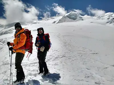
The Annapurna Circuit Trek, one of Nepal’s most famous treks, draws adventurers from around the globe. This trek, spanning 160-230 kilometers, offers breathtaking views of the Annapurna and Dhaulagiri Mountain ranges and rich cultural experiences. To confidently navigate this challenging yet rewarding trek, a reliable Annapurna Circuit Trek Map is essential. This map not only aids in planning the route but also ensures that trekkers can explore the terrain with assurance.
When choosing an Annapurna circuit map, trekkers should consider both physical and digital versions. A detailed Annapurna circuit trekking map highlights major landmarks, accommodation spots, and key points of interest along the trail.
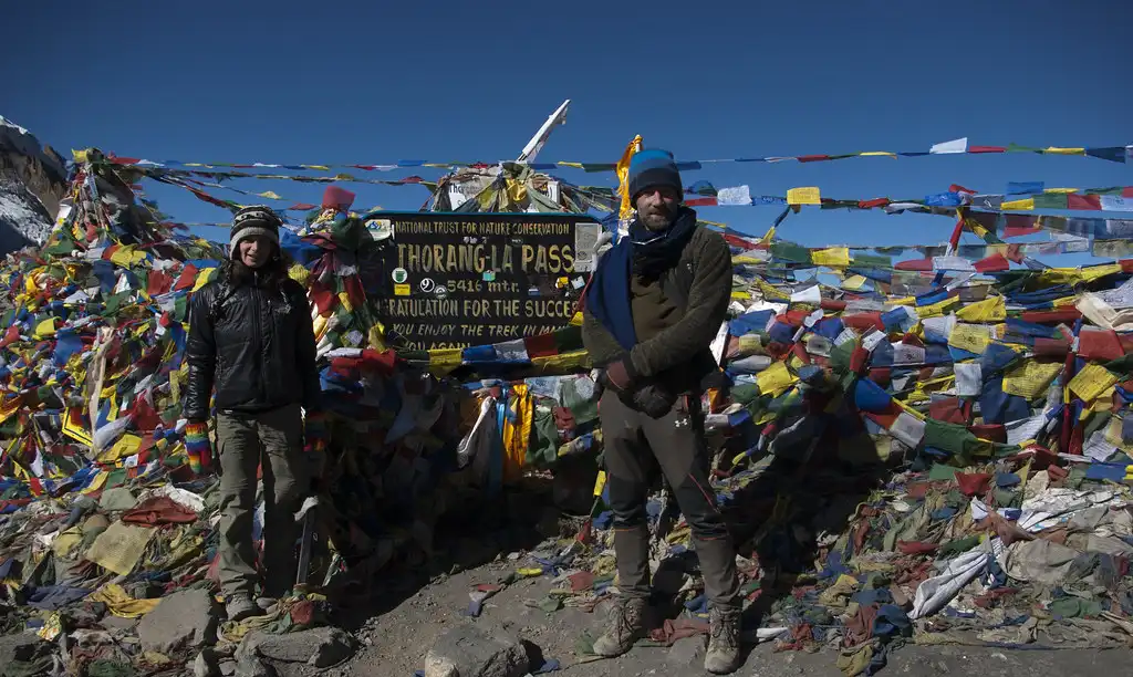
The Annapurna region map includes detailed topography, which is crucial for understanding elevation changes and preparing for the trek’s physical demands. An Annapurna trail map clearly shows the paths and alternative routes, allowing for a flexible trekking plan. The Thorong La Pass, a significant section of the trek, is extensively featured on the Thorong La Pass map. This segment is vital for planning the high-altitude part of the trek and ensuring safe passage.
The Annapurna circuit trek route map details the entire circuit from Besisahar to Nayapul, including all side trails and variations of the circuit Annapurna trek. Using these maps together helps trekkers understand the layout of the Annapurna circuit trek and make informed decisions throughout their trip.
Annapurna Circuit Trek
Annapurna Base Camp Trek
Mini Annapurna Circuit Trek
Choosing the Right Map
Selecting the right map is crucial for successfully navigating the Annapurna Circuit trek. Trekkers can choose between physical maps and digital maps, each with distinct benefits. Physical maps offer reliability and detail, covering the entire route without needing battery power or internet connectivity.
In contrast, digital maps are accessible via smartphones or GPS devices, featuring interactive elements such as location tracking and route suggestions. To find the most reliable maps, look to reputable publishers and trekking companies. Himalayan Map House produces detailed and up-to-date maps for the Annapurna Circuit, which experienced trekkers highly recommend.
You can purchase these maps at bookstores in major cities like Kathmandu and Pokhara or order them online in advance. Additionally, digital map applications such as Maps or the offline functions of Google Maps offer useful GPS tracking and route details, making them valuable tools for real-time navigation.
Annapurna Circuit Map: Itinerary Route
Day 01: Arrival in Kathmandu (1300m)
Day 02: Drive from Kathmandu to Chamje via Besishahar (1410m) – 9 hours
Day 03: Trek from Chamje to Dharapani (1860m) – 6-7 hours
Day 04: Trek from Dharapani to Chame (2650m) – 5-6 hours
Day 05: Trek from Chame to Upper Pisang (3300m) – 5-6 hours
Day 06: Trek from Upper Pisang to Manang via Ghyaru (3520m) – 6-7 hours
Day 07: Acclimatization Day in Manang (3520m)
Day 08: Trek from Manang to Yak Kharka (4035m) – 3-4 hours
Day 09: Trek from Yak Kharka to Thorong Phedi or High Camp (4540m/4880m) – 3-5 hours
Day 10: Trek from Thorong Phedi/High Camp to Muktinath via Thorong La Pass (5416m) (3800m) – 7-8 hours
Day 11: Drive from Muktinath to Tatopani via Jeep (1100m) – 6-7 hours
Day 12: Trek from Tatopani to Ghorepani (2800m) – 7-8 hours
Day 13: Trek and Drive from Ghorepani to Pokhara via Poon Hill (3210m) and Tikhedhunga (900m) – 7-8 hours
Day 14: Drive from Pokhara to Kathmandu (1300m) – 6-7 hours
Day 15: Departure from Kathmandu (1300m)
Key Features of the Annapurna Circuit Map
A reliable Annapurna Circuit map provides detailed insights into major landmarks, ensuring trekkers navigate the route with ease. It clearly marks key landmarks such as Thorong La Pass, Muktinath Temple, and the village of Manang, helping trekkers plan their daily goals and rest stops. The map also highlights significant cultural sites, including ancient monasteries and traditional villages, offering opportunities for enriching cultural experiences.
Prominently featured natural landmarks like rivers, forests, and mountain peaks such as Annapurna and Dhaulagiri guide trekkers through the region’s diverse landscapes. The symbols and topography used in Annapurna trekking maps are crucial for navigation and preparation. Contour lines show elevation changes, helping trekkers understand the terrain’s gradient and prepare for ascents and descents.
Symbols such as tents for camping sites, bed icons for teahouses, and forked lines for trail junctions provide practical information for planning overnight stays and route choices. Blue and green hues represent rivers, glaciers, and forested areas, while grey and white depict rocky terrains and high-altitude passes. These visual cues help trekkers anticipate and adapt to the changing environments they will encounter along the trail.
Ghorepani Poon Hill Trek
Mardi Himal Trek
Dhaulagiri Trek
Navigating the Annapurna Circuit
To navigate the Annapurna Circuit from Besisahar to Thorong La Pass using the map, follow these detailed steps. You can start by locating Besisahar and follow the marked trail towards Chamje. The map shows major landmarks, rivers, and village names, helping you stay on track. As you trek, use the map to find key stopping points such as Dharapani, Chame, and Manang. Each stop is clearly marked, making it easier to set daily trekking goals and plan rest periods.
When you reach Manang, take an extra day to acclimatize, as the map indicates increasing elevations ahead. From Manang, follow the trail to Yak Kharka and then to Thorong Phedi or High Camp. The map highlights these locations and provides elevation markers. From High Camp, follow the map’s path to Thorong La Pass, the trek’s highest point at 5416 meters. Stick to the indicated route to ensure a safe and successful crossing.
Interpret elevation changes and trail difficulty on the map, as well as understand the contour lines and symbols. Close contour lines indicate steep terrain, while wider-spaced lines suggest a gentler slope. It helps you anticipate the difficulty of each trek section.
Check altitude markings at key points to gauge elevation gains and prepare for altitude adjustments. The map might highlight rocky or snowy sections by using different colors or symbols to denote trail types and difficulty levels. Paying attention to these details helps you prepare for the trek’s physical demands and ensure you carry the right gear and supplies.
Highlighting Must-See Spots
1. Manang
Mananga sits at an altitude of 3520 meters and is one of the major halting points of the Annapurna Circuit. Travelers use Manang as an important acclimatization point before climbing to the highest peak of the Annapurna region. Manang village offers panoramic views of the Annapurna range and is a must-visit for photographers. Manang has a lot of Tibetan culture, with ancient monasteries and traditional houses, giving you a glimpse of the local way of life.
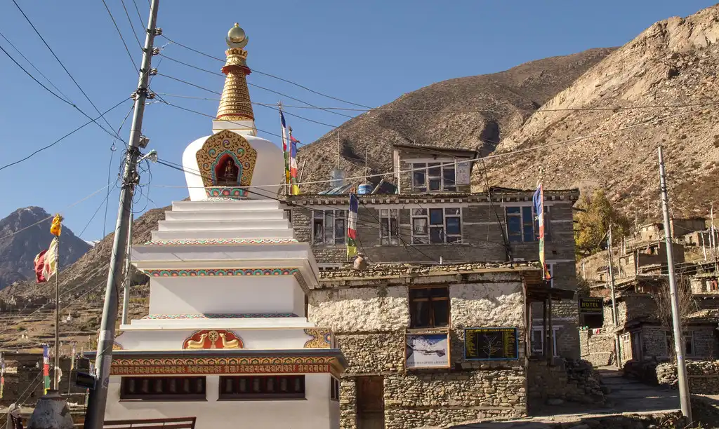
Travelers can explore local shops, enjoy a variety of foods in tea houses, and gain vital knowledge about altitude sickness from the Himalayan Survival Society. Manang also serves as a base for several rewarding short hikes. Treks to Gangapurna Lake and Ice Lake start from here, offering spectacular panoramic views of the surrounding mountains and valleys.
These hikes are perfect for acclimatization and provide a good opportunity to experience the natural beauty of the Annapurna region up close. With its blend of stunning scenery, cultural richness, and strategic importance, Manang stands out as a highlight of the Annapurna Circuit trek.
2. Muktinath
Muktinath sits at an altitude of 3800 meters, just outside Thorong La Pass. Muktinath attracts pilgrims from all over the world, as it is a holy place for both Hindus and Buddhists. The Muktinath temple, famous for its permanent fireworks and 108 waterfalls, is a major attraction. The cathedral also houses a Buddhist monastery, adding to its spiritual significance.
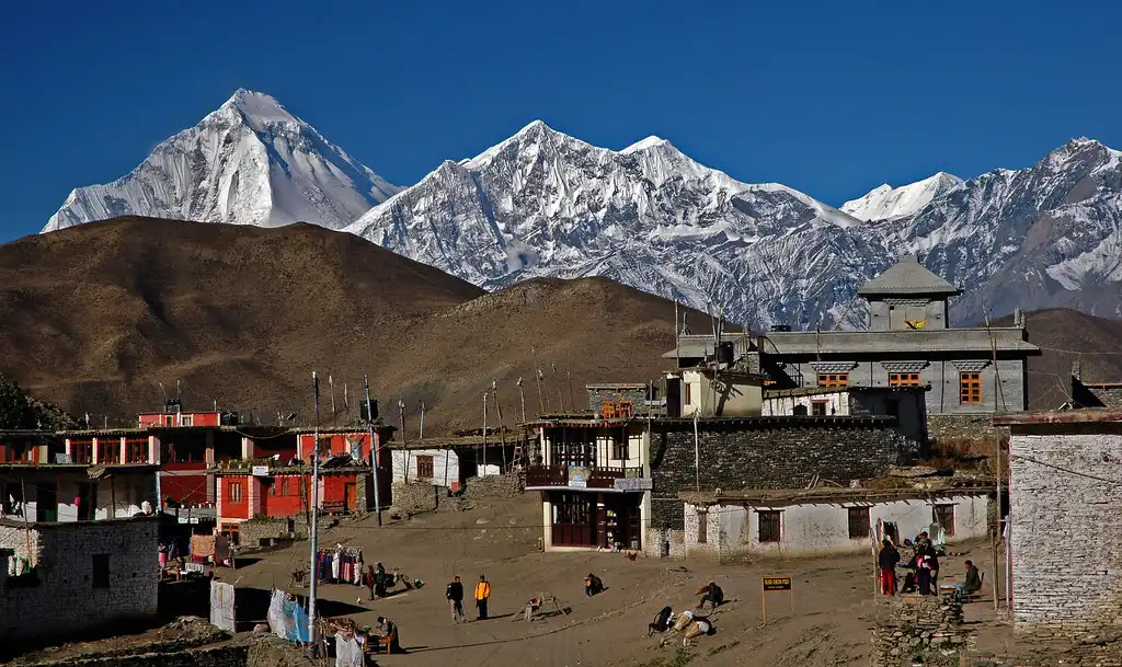
After crossing the challenging Thorong La Pass, trekkers find Muktinath to be a haven for physical and spiritual rejuvenation. The serene environment and profound spiritual atmosphere make Muktinath a memorable and peaceful stop on the Annapurna Circuit trek.
3. Poon Hill
Poon Hill stands at an altitude of 3210 meters and is a popular sight near Ghorepani. Poon is famous for its breathtaking sunrise views of Dhaulagiri and Annapurna ranges. Hikers often get up early to walk to the observation deck and catch the first light of dawn illuminating the snow-capped mountains.
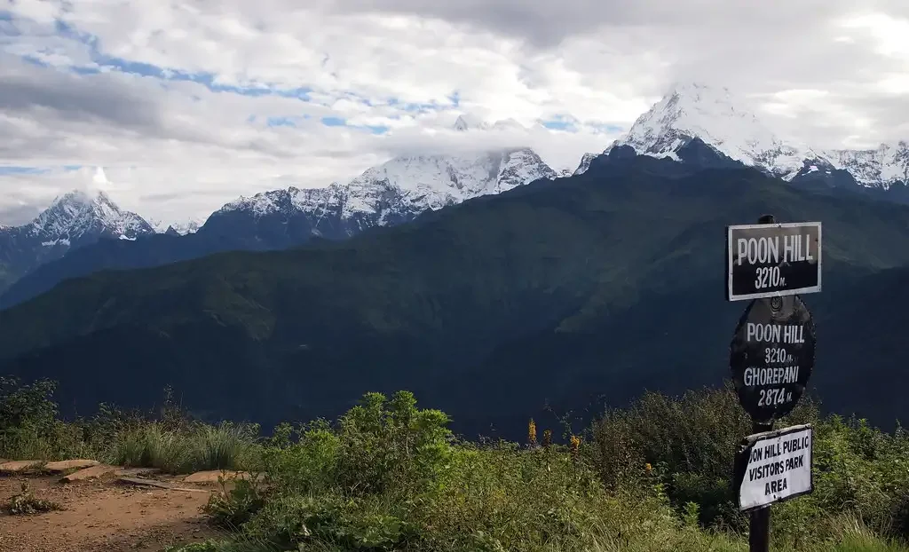
The panoramic vista from Poon Hill includes Annapurna South, Machhapuchhre (Fishtail), Himchuli, and Dhaulagiri, among others. This spot is a photographer’s dream, offering some of the most iconic images of the Himalayas. Standing on Poon Hill, surrounded by the grandeur of the Himalayas, is a cherished highlight for many trekkers.
4. Gangapurna Lake
Near Manang, at an elevation of 3500 meters, Gangapurna Lake is located. Gangapurna Lake, created by the glacial melt of Gangapurna Mountain, showcases a stunning turquoise expanse against towering peaks.
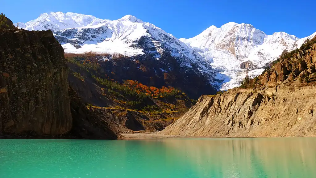
You can easily access the lake from Manang, which offers a serene spot for reflection and photography. The short trail to the lake provides trekkers with excellent views of the Annapurna range and the surrounding landscape. Gangapurna Lake serves as a peaceful retreat where trekkers can relax and immerse themselves in the natural beauty of the Himalayas.
5. Thorong La Pass
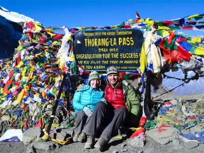
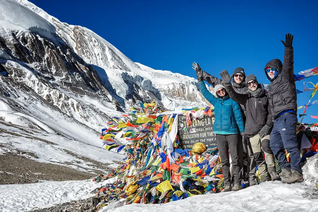
The highest point of the Annapurna Circuit is at an elevation of 5416 meters. Thorong La Pass stands out as a major highlight of the Annapurna Circuit, marking the trek’s highest and most challenging point. Crossing this pass is a significant achievement for trekkers, offering breathtaking views of the surrounding peaks and valleys.
The climb is strenuous and requires proper acclimatization and preparation. However, the sense of accomplishment and the stunning panoramic views make the effort worthwhile. The descent from the pass leads to Muktinath, enhancing the significance of this remarkable crossing.
6. Tatopani
At an elevation of 1100 meters, Tatopani is known for its natural hot springs. After days of trekking, Tatopani provides welcome relief with its natural hot springs. Trekkers can soak in warm, mineral-rich waters believed to have therapeutic properties. The village itself is charming, surrounded by lush greenery and enjoying a pleasant climate.
Tatopani offers the perfect spot for relaxation and rejuvenation, making it a favorite among trekkers. The combination of natural beauty and soothing hot springs makes Tatopani a must-visit location on the Annapurna Circuit.
Accommodation During Trek
Trekkers on the Annapurna Circuit stay in cozy teahouses and lodges that provide basic yet comfortable accommodations. In bustling villages like Manang, teahouses offer private rooms, shared bathrooms, and dining areas serving a variety of local and international cuisines.
These teahouses give trekkers a warm bed and hearty meals, crucial for recovery after long trekking days. Many also provide Wi-Fi, hot showers, and charging facilities for an additional fee, ensuring trekkers stay connected and refreshed.
As trekkers move to higher altitudes, accommodations become simpler but still offer essential comforts. At stops like Thorong Phedi or High Camp, teahouses provide communal sleeping areas and basic amenities, focusing on warmth and shelter against harsh mountain conditions.
Despite their simplicity, these teahouses maintain warm and welcoming hospitality, with hosts offering hot meals and drinks to keep trekkers nourished and ready for the challenging days ahead. These teahouses play a vital role in the trekking experience, providing a place to rest, recover, and connect with fellow trekkers.
Best Times to Trek
Spring (March to May)
Spring offers one of the best times to trek the Annapurna Circuit. During these months, trekkers enjoy mild weather, with temperatures ranging from 10 to 20 degrees Celsius at lower elevations and cooler temperatures at higher altitudes.
The trails, detailed on any Annapurna Circuit Trek Map, bloom with rhododendrons and other wildflowers, creating a picturesque landscape. Excellent visibility provides clear views of the snow-capped peaks and lush valleys. The relatively dry season reduces the chances of rain, making the trek more enjoyable.
Autumn (September to November)
Autumn is another ideal season for trekking the Annapurna Circuit. Following the monsoon season, the trails become lush and green. Stable weather, with temperatures ranging from 10 to 15 degrees Celsius at lower elevations and cooler temperatures at higher altitudes, creates perfect trekking conditions.
The Annapurna Circuit Trek Map clearly marks stunning views of the Annapurna and Dhaulagiri ranges. Dry trails and favorable conditions make autumn a popular time for trekking. During this season, festivals like Dashain and Tihar offer trekkers a chance to experience local culture and traditions.
Winter (December to February)
Winter trekking on the Annapurna Circuit is less popular due to cold temperatures and heavy snowfall at higher altitudes. However, those seeking solitude and a more challenging trek find winter a rewarding time to visit.
Temperatures can drop to -10 degrees Celsius or lower at high altitudes, while lower elevations remain cooler but manageable. The Annapurna Circuit during winter presents breathtaking snowy landscapes and quieter trails, making it an adventurous choice for experienced trekkers.
Monsoon (June to August)
The monsoon season is the least favorable time to trek the Annapurna Circuit due to heavy rainfall, leeches, and slippery trails. Frequent showers make the trails muddy and challenging to navigate.
However, some trekkers still choose this time for the lush green landscapes and fewer crowds. The Annapurna Circuit Trek Map indicates that trekking in rain shadow areas like Manang and Mustang can be an alternative during this season, as they receive less rainfall.
How Difficult is the Annapurna Circuit Trek?
If you are considering this Himalayan adventure and are curious about the overall difficulty level of the Annapurna Circuit Trek, rest assured that it is manageable and manageable. The difficulty level of the Annapurna Circuit is generally considered ‘moderate.’
Even if you are a complete beginner to Himalayan trekking, this adventure is manageable. With proper preparation and determination, you can conquer this popular trekking route with ease.
However, prepare for some challenging sections, as with any Himalayan exploration. Despite these challenges, they are milder compared to other remote adventures, making the trek more accessible.
Altitude Sickness: Altitude sickness presents a significant challenge on the Annapurna Circuit Trek. As trekkers ascend to higher elevations, the risk of altitude-related illnesses increases. Symptoms such as headaches, nausea, dizziness, and shortness of breath are common.
Proper acclimatization is crucial to prevent serious conditions like Acute Mountain Sickness (AMS) or High Altitude Pulmonary Edema (HAPE). The Annapurna Circuit Trek Map highlights key acclimatization points, such as Manang, where trekkers should spend extra time adjusting to the altitude. Trekkers should ascend slowly, stay hydrated, and pay attention to their body’s signals to manage altitude sickness effectively.
Trekking Duration: Completing the Annapurna Circuit Trek takes 15 to 18 days, depending on the chosen itinerary. The trek spans approximately 160-230 kilometers, with daily trekking hours ranging from 5 to 7 hours.
The Annapurna Circuit Trek Map provides detailed information on daily segments, helping trekkers plan their pace and overnight stops. The long duration and daily physical exertion demand good fitness levels and stamina. Trekkers should prepare by engaging in regular cardiovascular exercises and strength training before starting the trek.
Weather Factors: Weather conditions significantly impact the difficulty of the Annapurna Circuit Trek. Spring and autumn offer the best weather, with mild temperatures and clear skies. However, trekkers must still prepare for sudden weather changes, especially at higher altitudes.
In winter (December to February), cold temperatures and heavy snowfall increase the trek’s difficulty. The monsoon season brings heavy rainfall, making trails slippery and prone to landslides. The Annapurna Circuit Trek Map includes weather patterns and expected conditions for each season, helping trekkers plan accordingly and pack appropriate gear.
Remoteness: The remoteness of certain sections of the Annapurna Circuit adds to its difficulty. While some parts of the trail pass through well-developed villages with ample facilities, other sections are more isolated and need more access to medical services and supplies.
The Annapurna Circuit Trek Map highlights remote areas where trekkers need to be self-sufficient and prepared for emergencies. Trekkers should also be mentally prepared for the solitude and physical demands of trekking through remote mountainous terrain.
Planning and Preparation for the Trek
1. Physical Fitness and Training
Physical conditioning for the Annapurna Circuit Trek is essential to deal with the daily physical exertions and long hours of trekking. Start training at least three to six months before the trip.
Cardiovascular exercises like running, cycling, and swimming will build endurance. In addition, practice walking on different terrains with a loaded backpack to simulate walking conditions. Gradually increase the intensity and duration of your exercises to increase your endurance and ensure you are well-prepared for the trek.
2. Acclimatization and Altitude Awareness
Proper acclimatization is essential to prevent altitude sickness during the Annapurna Circuit Trek. Plan your itinerary to include acclimatization days, especially at higher altitudes.
The Annapurna Circuit Trek Map highlights key acclimatization points, such as Manang, where you should spend extra time adjusting to the altitude. Trek slowly, allowing your body to adjust to the drop in oxygen levels. Stay hydrated, avoid alcohol, and listen to your body. If you see disease at higher altitudes, move to lower altitudes and seek medical advice if necessary.
3. Packing Essentials
Packing the right gear is vital for a successful trek. Bring layered clothing to adjust to varying temperatures, including moisture-wicking base layers, insulating mid-layers, and waterproof outer layers.
Essential items include a good-quality trekking backpack, sturdy trekking boots, a sleeping bag, and trekking poles. Also, could you pack a first aid kit, water purification tablets, and high-energy snacks? A detailed Annapurna Circuit Trek Map is crucial for navigation. Remember essentials like sunscreen, sunglasses, a hat, and personal hygiene items. Pack light, but ensure you have everything necessary for the trek.
4. Permits and Documentation
Before starting the Annapurna Circuit Trek, obtain the required permits. You need the Annapurna Conservation Area Permit (ACAP) and the Trekker’s Information Management System (TIMS) card.
These permits help maintain the region’s natural beauty and track trekkers’ safety. Obtain these permits in Kathmandu or Pokhara from the respective offices. Carry multiple copies of your passport-sized photographs and important documents. Keep a digital copy of all essential documents as a backup.
5. Mental Preparation and Research
Understand the challenges and difficulties you might face during the trek, such as long trekking hours, altitude sickness, and varying weather conditions. Read about the experiences of other trekkers and gather tips on managing the trek.
Familiarize yourself with the route using the Annapurna Circuit Trek Map, understanding key landmarks and acclimatization points. Stay positive, set realistic expectations, and be prepared to adapt to changing conditions. A well-prepared mindset will help you handle the trek’s challenges and enjoy the trek to the fullest.
6. Booking and Logistics
Plan your trek well in advance, including flights, accommodations, and transportation. Book your flights to and from Nepal early to secure the best rates. Arrange accommodations in Kathmandu and Pokhara, and book teahouses along the trekking route if possible.
Organize transportation to the trek’s starting point and from the endpoint. Consider hiring a guide or porter for added support and to enhance your trekking experience. They can provide valuable local knowledge, carry your gear, and assist in navigating the route.
Annapurna Region Map
The Annapurna Region Map encompasses a wide area, detailing both popular trails and lesser-known routes. This map enables trekkers to navigate the region efficiently, ensuring they maximize their trekking experience. By studying the Annapurna Region Map, trekkers can plan their routes, pinpoint key landmarks, and locate essential facilities along the trek.
You can familiarize yourself with the map, and you can safely explore various places in the Annapurna region. From tropical villages to isolated mountain roads, the map provides essential information on elevation changes, trails, and views to get you on your way, and it has all been successful.
Tips for Using the Annapurna Circuit Trek Map
Reading and interpreting the Annapurna Circuit Trek Map is essential for a successful trek. Whether you use a digital map on your smartphone or a physical map, understanding its features will boost your navigation skills. Learn key symbols, such as trail markers, elevation lines, and landmarks, to ensure you stay on the correct path.
You can use the Annapurna Circuit Trek Map to plan your daily routes and pinpoint important rest stops, water sources, and accommodation options. Please check the map during your trek to track your progress and make necessary adjustments. Mastering the use of the map will enhance your trekking experience, making your trip safer and more enjoyable.
Conclusion
Using the Annapurna Circuit Trek Map effectively offers numerous benefits. It ensures you stay on the right path, identify key landmarks, and make informed decisions about your route. By mastering the map’s features, you can navigate the trek with ease, enhance your safety, and appreciate the stunning landscapes and cultural experiences along the way.
Embrace the adventure with confidence, knowing the Annapurna Circuit Trek Map is a valuable tool in your trekking arsenal. With preparation and a solid understanding of the map, you can enjoy a rewarding and memorable trek through one of the world’s most iconic trekking routes.

